Boundary survey is primarily concerned with determining the corners of a parcel of land. Before buying, dividing, improving, or building on land, most people hire a land surveyor. Surveyor, surveyingthe land before these activities ensures avoidance of future disputes, the expense and frustration of defending a lawsuit, moving a building, or resolving a boundary problem.
Sub Division Survey
Subdivisions may be simple, involving only a single seller and buyer, or complex, involving large tracts of land divided into many smaller parcels.
The intention is to cover all subdivision of land where the immediate or ultimate purpose is that of selling the lots or building on them. Subdivision used for housing land, farm land, hills land, and large estate lands etc…
Survey Number Verification / Rectification Deed
First, consult a land surveyor to check the wrong survey number is verified.A rectification deed is gives buyers and sellers the scope to correct mistakes in documents like sale deeds and title deeds. A rectification deed is also referred to as a deed of confirmation, correction deed, supplementary deed, amendment deed, etc.
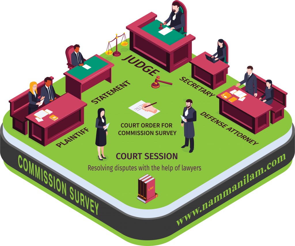
Commission Survey
Commission Survey is not necessary in a case for a simple injunction, where the property is identified with certainty based on the local commission report, though the other side disputes the identity. Plaint schedule items based on a survey commission report and plan is absolutely necessary. It will advisable to engage senior and or experienced surveyors on these surveys.
Deed Survey & Register
For a deed to be legal it must state the name of the buyer and the seller, describe the property that is being transferred, and include the signature of the party that is transferring the property. Before deed register we, namma nilam engineer team survey and attached the plan to the deed.
Partition Survey
A partition is a division of a property held jointly by several persons, so that each person gets a share and becomes the owner of the share allotted to him. It is done by dividing the property according to the shares to which each of the parties is entitled to in law as applicable to them.
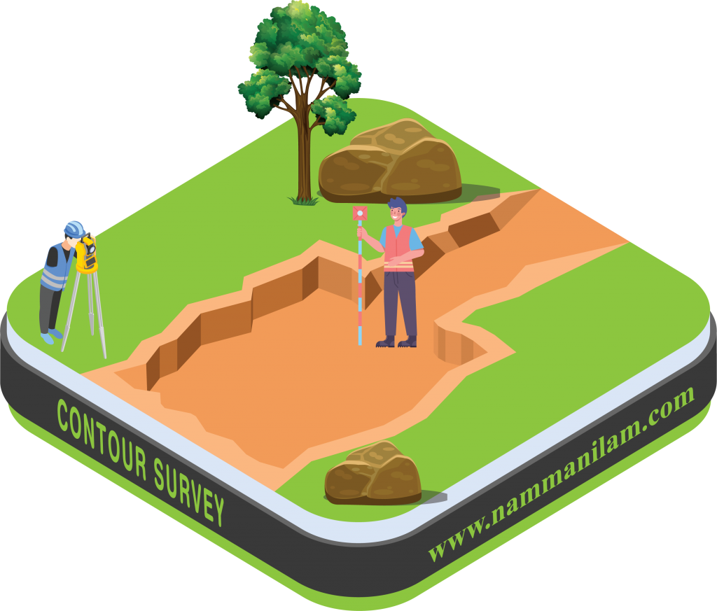
Contour Survey
Slopes matching the same height are joined using imaginary lines that are known as contours. Based on the findings of contour survey, the design team can decide on cutting, filling, widening, and leveling the land. Contour survey engineering project such as a road, a railway, a canal, a dam, a building etc.
Hill Survey
The only difference is that the topographical features in a hilly area will be different from plain land that consists of buildings, roads, culverts, etc., Hill survey covers rock, boulders, and obstructive walls or so. There will be more undulation with regard to the existence of the Hill. You need to use numerical methods to calculate the surface area of the hilly region. There are a lot of different mathematical models that can be put to use to find areas of irregular regions and shapes.
Lake Survey
The survey starts at the perimeter and then works back and forth across the lake body, assigning waypoints that are correlated with depth, vegetation, and sedimentation to provide accurate and detailed reporting. Water Supply to file periodical reports regarding the progress and action taken for implementation of the directions, including removal of encroachments found during the survey entire directions and process are completed.
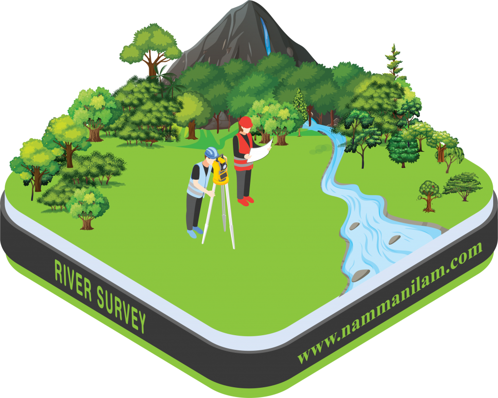
River survey
Landform Surveys has surveyed rivers largely to do a flood risk assessment, either before or after flooding has occurred. It’s not just buildings or bridges that can make a difference to the flooding possibilities of a river. Even the addition of flood defenses, drainage or utilities, nearby roads and erosion prevention, while good intentioned can be detrimental if not evaluated properly.
Road Survey
The relevant road survey will be carried out by using Total Station Survey / Measuring Tape.Maps to be submitted along with project report General map of the country through which the proposed road will pass. Route survey map. Longitudinal section. Cross-section Detailed drawing of culverts, bridges, flyovers, etc
Topographic Survey
Topographic map surveys are carried out to measure land surface features and levels at the project site for various purposes such as urban and regional planning, design of road and utility lines projects, site leveling, volumes and quantities calculations, scales, and formats are used.
Total Station Survey
Total Station Survey is used to record the absolute location of the tunnel walls, ceilings, and floors as the drifts of an underground mine are driven. Total stations are mainly used by land surveyors and civil engineers, to set out features such as roads, houses or boundaries.
Drone Survey
Drone mapping is the practice of acquiring hundreds of aerial images using drones and stitching them together digitally with specialized mapping software to develop a larger and more accurate composite image. The surveying principle used for drone mapping is photograph.
Interior Survey
A site survey is a simple 2D drawing of your space that shows all dimensions and features, such as doors, windows and columns. A good site survey provides a foundation for our experts to begin developing your new layout and design. For measuring and surveying interior spaces. Equipment for measuring, Researching before you survey, Create a symbols legend, Tour the building first, sketch the room, Measure the room, Take photographs.
Architecture
Architecture
The profession of designing buildings, open areas, communities, and other artificial constructions and environments, usually with some regard to aesthetic effect. Architecture often includes design or selection of furnishings and decorations, supervision of construction work, and the examination, restoration, or remodelling of existing buildings.
Construction Jobs
Construction work covers delivering buildings, infrastructure, and industrial facilities and associated activities through to the end of their life. It typically starts with planning, financing, and design, and continues until the asset is built and ready for use; and also covers repair, maintenance work, any works to expand, extend and improve the asset.
Elevation
When the height of a point is its vertical distance above or below mean sea level the surface of a reference plane you have selected that point.
The front elevation is the front-facing of the building or house in architecture. It is part of a set of architectural drawings. The elevation is specifically used by architects to illustrate a two-dimensional view of building in architecture
Plan Approval
If someone wishes to make a layout in a land, they need to approach DTCP. They approve the layout after verifying the road width, area meant for parks or green belt, play grounds, recreation areas etc. On approval of layout the developer can sell the plots or construct residential units by himself. For construction another set of permission is needed.
Layout Plot Marking
Layout drawing is prepared comprising roads, plots and allotting commercial spaces, public use space, etc… as required by government norms. The concerned layout plot is being marked at respective site as directed and guided by the site engineer of the client.
Combined FMB Sketch
If you are buying a land measuring 5 acres in which every acre of land Is owned by different persons and if you want to make it is to a single drawing. Since you are a single owner of the 5 Acres, You combine all the 5 different drawings in one drawing. This is called Combined FMB Sketch.This may extend up to combining many villages.
Design in AutoCAD / Plan Plotting by Manual
AutoCAD can be used for drafting and design projects that involve creation, editing, viewing or printing various types of geometric 2D and 3D entities. This includes projects like floor plans, construction layouts, building details, manufacturing drawings and layouts. Creating and Modifying Objects with Accuracy for Design and Drafting…
Graphic Design
Graphic design is a form of communication that uses colors, shapes, images, and words to create visual content that surrounds us in many forms—namely, print and digital media. Effective designs communicate information in a way that inspires and informs consumers, making it a critical element for any business’ success. We design( Logo, Visiting Card, Wedding Card, Pamphlet, Boucher, Albums, etc…)
Interior Design
Interior design is the art and science of enhancing the interior of a building to achieve a healthier and more aesthetically pleasing environment for the people using the space. An interior designer is someone who plans, researches, coordinates, and manages such enhancement projects.